Filtered by:
- Item Type
4 items
- List
- Grid
A subscription to the Price Guide is required to view results for auctions ten days or older. Click here for more information
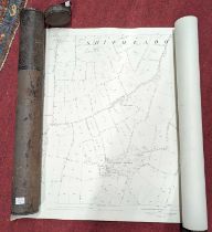

Lot 1068
Two rolled Ordnance Survey maps from the parish of Shipmeadow, Suffolk, dated 1884, in metal
Two rolled Ordnance Survey maps from the parish of Shipmeadow, Suffolk, dated 1884, in metal canister
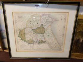
Lot 1070
J & C Walker - engraved and coloured County Map of The East Riding of Yorkshire, published 1836,
1070J & C Walker - engraved and coloured County Map of The East Riding of Yorkshire, published 1836,
J & C Walker - engraved and coloured County Map of The East Riding of Yorkshire, published 1836, 32 x 39cm
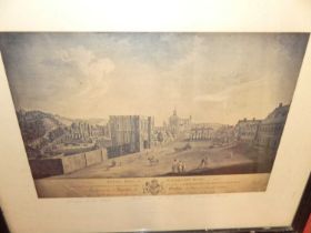
Lot 1078
Assorted prints, to include topographical engraving of Bury St Edmunds; Joseph Hogdskinson -
Assorted prints, to include topographical engraving of Bury St Edmunds; Joseph Hogdskinson - Survey map of Suffolk dated 1787, linen-backed; and a...

Lot 1090
After T.C. Hopland - A view from Richmond Hill, monochrome engraving, published London 1823, 43 x
After T.C. Hopland - A view from Richmond Hill, monochrome engraving, published London 1823, 43 x 59cm; together with another monochrome engraving...