Filtered by:
- Category
- List
- Grid
A subscription to the Price Guide is required to view results for auctions ten days or older. Click here for more information
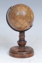

A 19th century miniature terrestrial globe, The Earth, published by J G Klinger, Nuremberg, the
A 19th century miniature terrestrial globe, The Earth, published by J G Klinger, Nuremberg, the printed gores in English, Australia as New Holland...
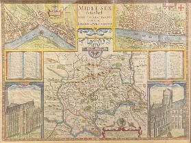
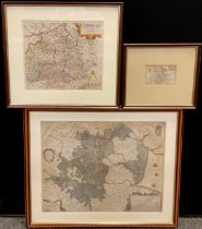
John Norden & John Speed, a two-page engraved hand-coloured map, Midle-sex (sic) described with
John Norden & John Speed, a two-page engraved hand-coloured map, Midle-sex (sic) described with the Most Famous Cities of London and Westminster, ...
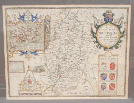
An 18th century two-page map, The Countie Of Nottingham, 40cm x 52cm
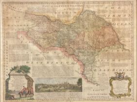
Emmanuel Bowen (1693/4 - 1767), a two-page coloured map, An Accurate Map of the North Riding of York
Emmanuel Bowen (1693/4 - 1767), a two-page coloured map, An Accurate Map of the North Riding of York Shire divided into its Wapontakes....., print...
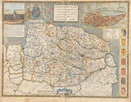
John Goddard (fl. 1645–1671), an engraved and coloured two-page map, Norfolk, A Countie Florishing &
John Goddard (fl. 1645–1671), an engraved and coloured two-page map, Norfolk, A Countie Florishing & Populous Described and Devided Armes Of Such ...
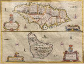
John Speed (1551/52 - 1629), a two-page coloured map, Jamaica and Barbados, sold by Thomas Basset in
John Speed (1551/52 - 1629), a two-page coloured map, Jamaica and Barbados, sold by Thomas Basset in Fleet Street, and Richard Chiswell in St Paul...
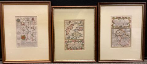
Maps - Owen, John & Bowen, Emmanuel, hand coloured engravings, London to Southampton, plate 128,
Maps - Owen, John & Bowen, Emmanuel, hand coloured engravings, London to Southampton, plate 128, 19cm x 12.5cm; The Road from London to Kings Lyn...
Maps - Van den Keere, Pieter (Flemish, 1571-c.1646), trio of hand coloured engraving maps, Surrey,
Maps - Van den Keere, Pieter (Flemish, 1571-c.1646), trio of hand coloured engraving maps, Surrey, 9cm x 12cm; Lancashire, 9cm x 12cm, Bishopric...
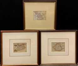
Maps - Jansson, Jan & Henricus Hondius, The Fens, engraved map, Latin and English text, A General
Maps - Jansson, Jan & Henricus Hondius, The Fens, engraved map, Latin and English text, A General Ploit and Description of the Fennes and surounde...
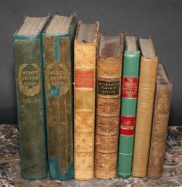
Antiquarian books - Natural History - Robert Mudie, Mudies British Birds, The Feathered Tribes of
Antiquarian books - Natural History - Robert Mudie, Mudies British Birds, The Feathered Tribes of the British Isles, in two volumes, published by ...
![Natural History – Bicknell (W[illiam] L.) The Natural History of the Sacred Scriptures and Guide](https://portal-images.azureedge.net/auctions-2024/bamfor10918/images/4ddb1e69-0e02-43c2-8cbf-b0e0011478ad.jpg?h=210)
Natural History – Bicknell (W[illiam] L.) The Natural History of the Sacred Scriptures and Guide
Natural History – Bicknell (W[illiam] L.) The Natural History of the Sacred Scriptures and Guide to General Zoology, London & New York, John Talli...
Science, chemistry – Muspratt, (James Sheridan, FRSE, MRIA, FGS, ed.), Chemistry, Theoretical,
Science, chemistry – Muspratt, (James Sheridan, FRSE, MRIA, FGS, ed.), Chemistry, Theoretical, Practical and Analytical as Applied and Relating to...
Topography, Derby & Derbyshire – Keys (John), ed. Gadd (George Frederick), Sketches of Old Derby &
Topography, Derby & Derbyshire – Keys (John), ed. Gadd (George Frederick), Sketches of Old Derby & Neighbourhood, Derby & London, Bemrose & Sons, ...
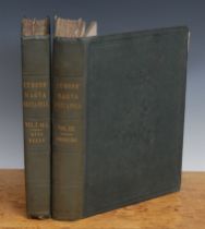
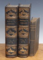
Topography, English Counties – Lysons, (Daniel FRS) & (Samuel, FRS, FSA), Magna Britannia, Being a
Topography, English Counties – Lysons, (Daniel FRS) & (Samuel, FRS, FSA), Magna Britannia, Being a Concise Topography of the Several Counties of G...
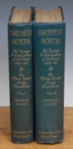
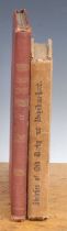
Topography, Travel – Nansen (Fridtjof) Furthest North: The Norwegian Polar Expedition 1893-1896, 2
Topography, Travel – Nansen (Fridtjof) Furthest North: The Norwegian Polar Expedition 1893-1896, 2 vols., Westminster, Archibald Constable 1897, 8...