
Filtered by:
- Category
- List
- Grid
A subscription to the Price Guide is required to view results for auctions ten days or older. Click here for more information
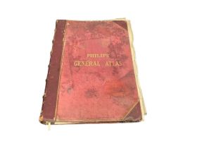

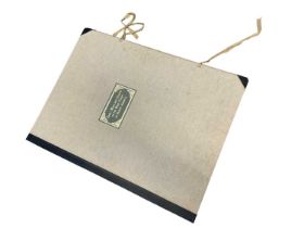
1862 Philips World Atlas, contents detached and possibly not complete, housing a large collection of
1862 Philips World Atlas, contents detached and possibly not complete, housing a large collection of maps
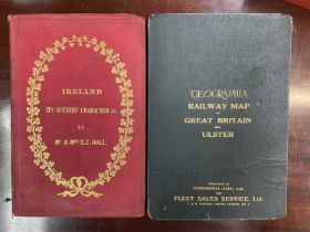
"Geographia" Railway Map of Great Britain and Ulster, 1923 for Fleet Sales Service, together with Ir
"Geographia" Railway Map of Great Britain and Ulster, 1923 for Fleet Sales Service, together with Ireland its Scenery Character by Mr & Mrs Hall (...
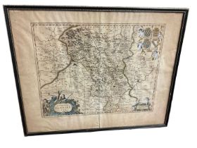
Jan Jansson, 17th century engraved map - ‘Comitatus Darbiensis', plate 39 x 49cm, glazed frame

19th century map of the county of Essex by C & I Greenwood in glazed frame.
Early maps and Charts of the East Coast of North America, housing 12 fine quality facsimiles of hist
Early maps and Charts of the East Coast of North America, housing 12 fine quality facsimiles of historic maps and charts, reproduced on fine paper...
Early maps and Charts of the West Coast of North America, housing 12 fine quality facsimiles of historic maps and charts, reproduced on fine paper...