Filtered by:
- Category
- List
- Grid
A subscription to the Price Guide is required to view results for auctions ten days or older. Click here for more information
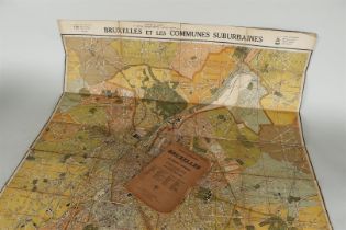

A topographical map on linen of Brussels, ca. 1900, with a legend.
Emanuel van der Hoeven, Life and death of the devious gentlemen Brothers Cornelis de Witt, Ruwaard van den Lande van Putten, etc. etc. and Johan d...
Apollos harp, consisting of Dutch mixtures of special materials Constantijn Huygens, Joost van den Vondel, Reyer Anslo, Jeremias de Decker, Jacob ...
J. v. Vondel, David's Harpzangen, published by Wed. Abraham Wees, Amsterdam 1657.
J. v. Vondel, Lucifer tragedy. in Amsterdam for Abraham de Wees, 1654. with title page.
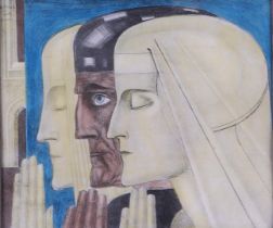
Johannes Theodorus 'Jan' (Poerworejo 1858 - 1928 The Hague), 'Prayer', signed and annotated (in the stone) (top left), hand-colored lithagraph.23 ...
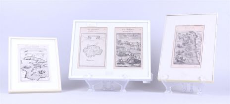
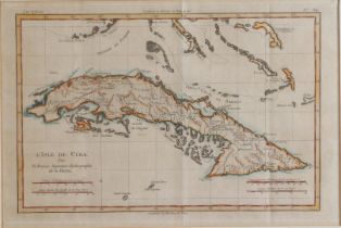
Alain Manesson Mallet, Maps of various regions: Cuba, Asia; Réunion, Mauritius, France, late 16th century. (3 maps and 1 print).
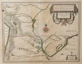
Rigobert Bonne (1727-1794); Nicolas Bellin (1703- 1772) - A map of Guadeloupe, including Dominique, colonies of France, 18th century.De eerste 30 ...
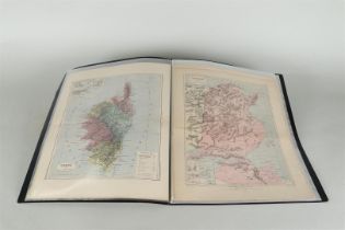
A folder with various pages with vertical maps from: Malte Brun, Atlas of the world, 19th century.
A folder with various pages with vertical maps from: Malte Brun, Atlas of the world, 19th century.
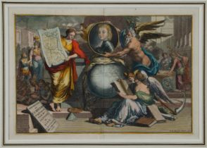
A hand-colored allegorical title page after L. van Vianen (Amsterdam ca. 1660 - after 1726)
A hand-colored allegorical title page after L. van Vianen (Amsterdam ca. 1660 - after 1726) drawn by Jan Goeree (Middelburg 1670 - 1731 Amsterdam)...
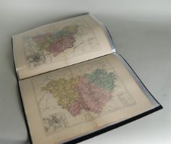
A folder with various pages with horizontal maps from: Malte Brun, Atlas of the world, 19th century.
A folder with various pages with horizontal maps from: Malte Brun, Atlas of the world, 19th century.
Guiljelmus BLAEU (1600-1699), Map depicting the area around Genoa - Regio cum Genuensis – ca 1600.
Guiljelmus BLAEU (1600-1699), Map depicting the area around Genoa - Regio cum Genuensis – ca 1600.
Three maps depicting various regions in the world: Cuba (Rigobert Bonne), Peru (N. Bellin), Martiniq
Three maps depicting various regions in the world: Cuba (Rigobert Bonne), Peru (N. Bellin), Martinique, (Tirion), 18th century.
Guiljelmus BLAEU (1600-1699), Map of part of the west coast of Latin America, Paraguay and the Rio de la Plata - 17th century.
Abraham Ortelius (Antwerp 1527 - 1598), (112), Map depicting Anatolia, Egypt and Cartagena, 16th century. Old colored.
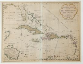
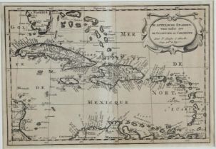
Isaak Tirion - Map depicting the Caribbean islands, Amsterdam, 18th century. Old-fashioned colored.
Isaak Tirion - Map depicting the Caribbean islands, Amsterdam, 18th century. Old-fashioned colored.
Abraham Ortelius (Antwerp 1527 - 1598), Map of Peru and Colombia - Peruviae auriferae regionis typus, 1603. Van den Broecke 15A33,7 x 22,3 cm.
Johann Baptista HOMANN (1664-1724) Map depicting Orleans and surroundings - Novissima totius Aureliani Generalitatis exhibitio, 1762.l.39.7 x 54.1...
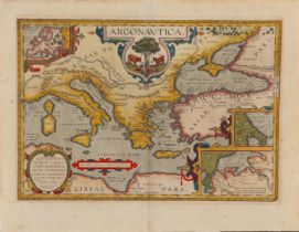
Abraham Ortelius (Antwerp 1527 - 1598), Map depicting the sea voyage of Jason and the Argonites
Abraham Ortelius (Antwerp 1527 - 1598), Map depicting the sea voyage of Jason and the Argonites - Argonautica, Antwerp, after 1601. Old-fashioned ...
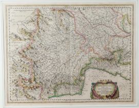
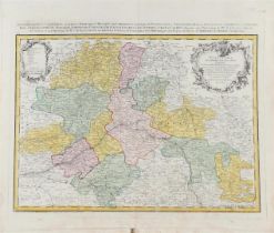
Caspar Merian (Frankfurt a. M. 1627-1686 Wieuwerd, Friesland) Map of Burgundy - Utriusque Burgundiae, Frankfurt am Main, ca. 1660. I.: 26 x 33.5/ ...
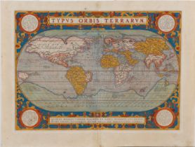
Abraham Ortelius (Antwerp 1527 - 1598), World map - Typys Orbis Terrarum, Amsterdam, 1570. Van den Broecke 5.Sheet: 35,8 x 49,2 cm.
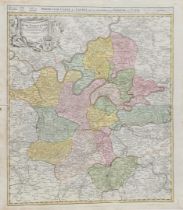
Johann Baptista HOMANN (1664-1724), Map of the Paris area - Historische Karte von der Gegend um Pari
Johann Baptista HOMANN (1664-1724), Map of the Paris area - Historische Karte von der Gegend um Paris, 1716.l.58.4 x 49.3 /sheet: 60.7 x 53.4 cm.
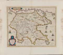
Guiljelmus (Willem) BLAEU (1600-1699), Map of the Peleponese (Greece) - Morea olim Peleponessus
Guiljelmus (Willem) BLAEU (1600-1699), Map of the Peleponese (Greece) - Morea olim Peleponessus, ca. 1640. l: 40.9 x 49.8/sheet: 55.7 x 64.3 cm.
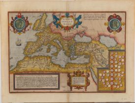
Abraham Ortelius (Antwerp 1527-1598) Map of the Ancient Roman Empire, Europe and North Africa - Romani Imperii Imago, Antwerp, 1587. Van den Broec...
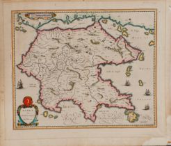
Guiljelmus BLAEU (1600-1699), Map of Greece - Morea olim Peloponessis, Amsterdam, 1666.
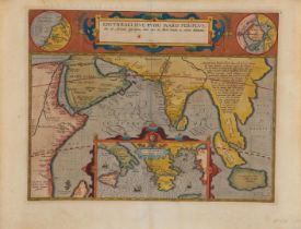
Abraham Orthelius (Antwerp 1527 - 1598), Map of the Indian Ocean and adjacent regions: Middle East, India and Southeast Asia - Erythraei Sive Rubr...
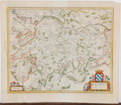
Joan Blaeu (1596-1673), A map of Burgundy - Burgundia Ducatus, Amsterdam, 1662.
Hand-colored engraving depicting the coast near Arkhangelsk, Russia (island of Novaya Zemlya), with title cartouche with measuring stick. With ins...
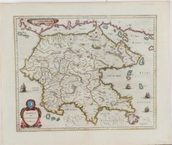
Guiljelmus BLAEU (1600-1699), Map of Greece - Morea olim Peloponessis, Amsterdam, 1666. l.: 49 x 40.2/ sheet: 59 x 51 cm.
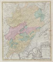
Johann Baptista HOMANN (1664-1724) Map of Burgundy - Comitatus Burgundiae (...), ca. 1710.I.: 57.1 x 47.9 / sheet61.1 x 53.3 cm.
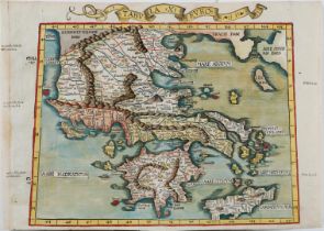
Hand-colored (contemporary) map of Greece. with a banderole at the top with the inscription: Tabvla /X/Euro(pa). Engraving on double page, vertica...
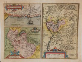
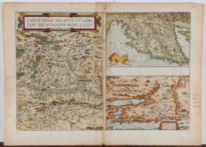
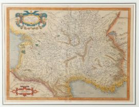
Abraham Ortelius (Antwerp 1527 - 1598) A map depicting southern France, Avignon and the Savoy - Gallia Narbonens/ Sabaudiae Ducat/ Venuxini Comita...
Abraham Ortelius (Antwerp 1527-1598), Map of three regions in Europe: Drava' (Carinthia, Austria), Adriatic Sea, Zadar and Sibenik (Croatia) - Car...
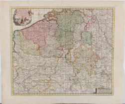
A colored copper engraving of Belgium. "Nova et Accurata Belgii Hispanici Galliciq. Tabula denuo bene Correcta in Partes perfect divisa et in luce...
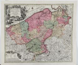
A copper engraving of Flanders. "Flandria maximus et pulcherrimus Europae Comitatus". Published by Matheus Seutter, Augsburg, 1730.50 x 58 cm.
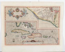
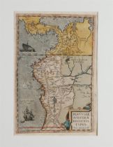
Abraham Orthelius (Antwerp 1527-1598), Map of the Caribbean - Culiacanae, Americae regionis, descriptio; Hispaniolae, Cubae (...), Antwerp, 1579) ...
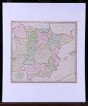
Seven various maps, including Europe, Russia, Germany, Italy and Spain, 19th century.Ong. 40 x 40 (excl. passe partout).
A selection of (7) various maps, including the Eurasian continent. 19th century.
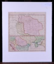
Gerhard MERCATOR (1512-1594, Map depicting Aquitaine - region in France 2nd quarter 17th century.
Gerhard MERCATOR (1512-1594, Map depicting Aquitaine - region in France 2nd quarter 17th century.
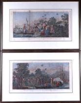
A lot consisting of (2) hand-colored prints by Bernard, depicting Captain Cook's landings. esp.: Débarquement á Middelburgh, L'une des isles frien...
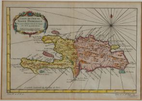
A lot consisting of (3) antique maps of the Antilles and Haiti: N. Sanson: "The Antillean Islands including De Lucaysche and the Caribbean: , M. B...