Filtered by:
- Category
- List
- Grid
A subscription to the Price Guide is required to view results for auctions ten days or older. Click here for more information

BARTHOLOMEW JAMES. The Imperial Map of England & Wales according to the Ordnance Survey. Large
BARTHOLOMEW JAMES. The Imperial Map of England & Wales according to the Ordnance Survey. Large double page eng. title, 14 double page col. maps (...
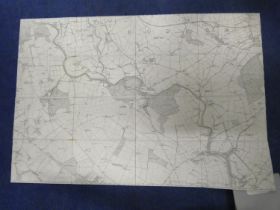
ORDNANCE SURVEY, Dumfriesshire. Roman Camps In Dumfriesshire. 4 maps, 6 inches:1 mile, each dissected & mounted on linen, for Birrenswark, Birren...
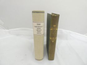
HEAD SIR FRANCIS B. The Emigrant. Half title with pres. inscription from the author to his niece.
HEAD SIR FRANCIS B. The Emigrant. Half title with pres. inscription from the author to his niece. Publisher's adverts. Soiled orig. pict. brds., ...
STOBIE MATHEW. A Map of Roxburgh Shire or Tiviotdale. Eng. map, hand col. in outline, poor cond.
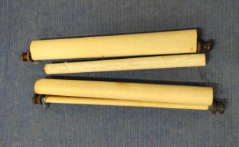
STOBIE MATHEW. A Map of Roxburgh Shire or Tiviotdale. Eng. map, hand col. in outline, poor cond. Rolled. 38" wide. 1770; also W. & A K. Johnston,...
WATSON JAMES. Plan of the Lands of Whitlaw & Lindean Situated Within the Parish of Galashiels. Pen,
WATSON JAMES. Plan of the Lands of Whitlaw & Lindean Situated Within the Parish of Galashiels. Pen, ink & watercolour. Rolled. 31" wide. 1839; al...
ARMSTRONG ANDREW & SON. A New & Correct Map of the County of Northumberland. Eng. map. Rolled.
ARMSTRONG ANDREW & SON. A New & Correct Map of the County of Northumberland. Eng. map. Rolled. 19" wide. 1770; also C. Smith, A New Map of the Co...
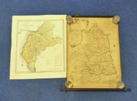
THOMSON JOHN. Peebles-shire, Berwick-shire & Selkirk Shire. 3 eng. maps, hand col. in outline. 1821
THOMSON JOHN. Peebles-shire, Berwick-shire & Selkirk Shire. 3 eng. maps, hand col. in outline. 1821 & 1824.
AINSLIE J. Plan of Jedburgh. Rolled, delicate cond. 48" wide. N.d.; also Map of Dumfriesshire
AINSLIE J. Plan of Jedburgh. Rolled, delicate cond. 48" wide. N.d.; also Map of Dumfriesshire from an Actual Survey by William Crawford, c.1820/1...
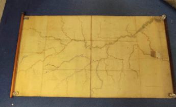
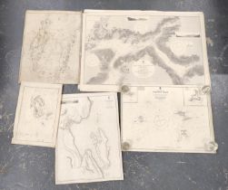
River Tweed. Very large pen, ink & watercolour Map of the River Tweed & Its Tributaries from St.
River Tweed. Very large pen, ink & watercolour Map of the River Tweed & Its Tributaries from St. Mary's Loch, Peebles, Abbotsford, Kelso, Paxton,...
KERR JOHN. Tweed Fisheries. 3 manuscript & watercolour maps showing the various beats. Each rolled,
KERR JOHN. Tweed Fisheries. 3 manuscript & watercolour maps showing the various beats. Each rolled, the largest 51" wide. 1857.
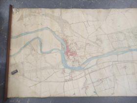
River Tweed. Early O.S. map with colouring of the River Tweed from Roxburgh Castle to Carnham
River Tweed. Early O.S. map with colouring of the River Tweed from Roxburgh Castle to Carnham including Kelso, with railways. Rolled. 47" wide; a...
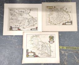
PONT T. & BLAEU J. Eusdail, The Merce & Tivedale. Three 17th cent. hand col. eng. maps. Each c.
PONT T. & BLAEU J. Eusdail, The Merce & Tivedale. Three 17th cent. hand col. eng. maps. Each c.16" x 20".
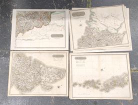
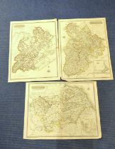
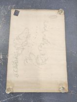
THOMSON JOHN. Southern Part of Western Isles, Middle Part of Western Isles (torn at hinge), Northern Part of Western Isles, Northern Part of Ross...
ROYAL COMMISSION (HIGHLANDS & ISLANDS). 10 various col. maps, mixed cond. Each 22" x 29". 1892;
ROYAL COMMISSION (HIGHLANDS & ISLANDS). 10 various col. maps, mixed cond. Each 22" x 29". 1892; also 3 others. (13).
Admiralty Charts. 6 large eng. charts, North West Scotland. Early 20th cent.; also 4 others related. (10).
Oakwood, Hutlerburn. Very large folded sectional OS 2nd ed. map, from Ettrickbridge to Selkirk,
Oakwood, Hutlerburn. Very large folded sectional OS 2nd ed. map, from Ettrickbridge to Selkirk, following the Ettrick. 1898; also pen, ink & wate...
AINSLIE JOHN. A Plan of the Lands of Langlands. Pen, ink & watercolour. 34" wide. 1778; also Plan
AINSLIE JOHN. A Plan of the Lands of Langlands. Pen, ink & watercolour. 34" wide. 1778; also Plan of the Estate of Boonraw Lees in the Parish of ...
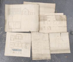
Scottish Borders. 9 various architectural plans, sketches & drawings for farm & estate cottages.
Scottish Borders. 9 various architectural plans, sketches & drawings for farm & estate cottages.
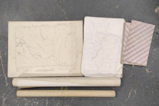
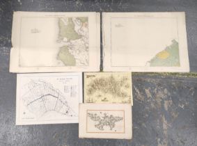
OS Maps. Pabbay, 1930, Sound of Berneray, 1930, Loch Duich, 1904 & Taransay, 1903; also various
OS Maps. Pabbay, 1930, Sound of Berneray, 1930, Loch Duich, 1904 & Taransay, 1903; also various other O.S. maps & photocopies thereof incl. Borde...
JOHNSTON W. & A. K. Map of the County of Argyle with the Railways. Eng. map with hand col. vignette
JOHNSTON W. & A. K. Map of the County of Argyle with the Railways. Eng. map with hand col. vignette plan of Campbeltown. Rolled. 30" wide; also a...
The Minch & The Hebrides, from Cape Wrath to Kyle. Map, hand col. in outline. Rolled. 30" wide. N.d.
The Minch & The Hebrides, from Cape Wrath to Kyle. Map, hand col. in outline. Rolled. 30" wide. N.d. but early to mid 19th cent.
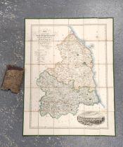
SHADFORTH & DINNING. Map of the County of Northumberland including the Town & County of Newcastle
SHADFORTH & DINNING. Map of the County of Northumberland including the Town & County of Newcastle Upon Tyne ... & ... Berwick Upon Tweed. Hand co...
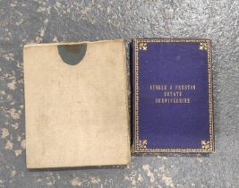
Bunkle & Preston Estate, Berwickshire. Pen, ink & watercolour fldg. map in blue cloth gilt brds. N.
Bunkle & Preston Estate, Berwickshire. Pen, ink & watercolour fldg. map in blue cloth gilt brds. N.d. but c.mid 19th cent.; also pen, ink & waterc...
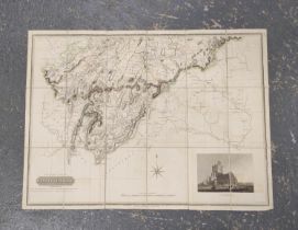
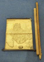
THOMSON JOHN. Northern Part of Roxburgh Shire & Southern Part of Roxburgh Shire. 2 fldg. eng. maps,
THOMSON JOHN. Northern Part of Roxburgh Shire & Southern Part of Roxburgh Shire. 2 fldg. eng. maps, hand col. in outline, with vignettes. 1822.
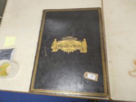
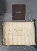
BARNES GEORGE EDWARD (Artist). "Sketches". 54 original watercolour & gouache mounted on one side
BARNES GEORGE EDWARD (Artist). "Sketches". 54 original watercolour & gouache mounted on one side only of leaves in a well worn Victorian album. ...
BARTHOLOMEW JOHN. New Reduced Ordnance Survey Map of the Counties of Lanark, Renfrew, Ayr, Stirling, Dumbarton &c. Fldg. eng. col. map in orig. b...