
Filtered by:
- Item Type
- List
- Grid
A subscription to the Price Guide is required to view results for auctions ten days or older. Click here for more information
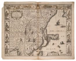

John Speed - 17th century engraved map - The Kingdom of China, sold by Baskett and Chiswell, English text verso, plate 40 x 51cmLoss to margins to...
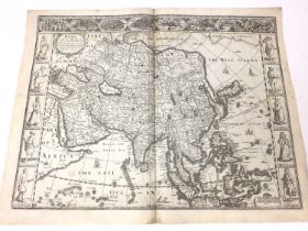
John Speed - 17th century engraved map of Asia, sold by Baskett and Chiswell, with English text verso, plate 40 x 51cm
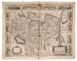
John Speed - 17th century engraved map of Tartary, sold by Baskett and Chiswell, English text verso, plate 39 x 50cm
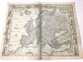
John Speed - 17th century engraved map of Europ and the chiefe Cities contayned therin ..., pen inscriptions to the margins, English text verso, p...
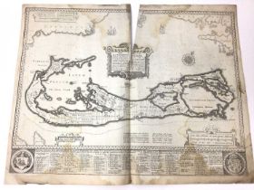
John Speed 17th century engraved map of Bermuda, sold by Baskett and Chiswell, plate 40 x 53cm, English text versoSignificant staining in various ...
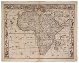
John Speed 17th century engraved map of Africa, engraved by Abraham Goos, English text verso, plate 40 x 52cm
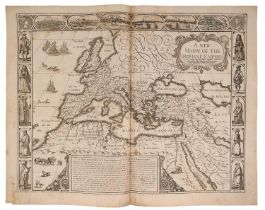
John Speed 17th century engraved map of The Romane Empire, English text verso, plate 41 x 50cm
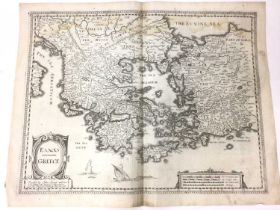
John Speed 17th century engraved map of Greece, sold by Baskett and Chiswell, English text verso, plate 41 x 50cm
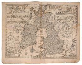
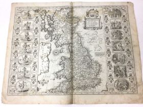
John Speed 17th century engraved map of The British Isles, English text verso, plate 41 x 50cm
Collection of John Speed Welsh maps, all circa 1627, Anglesey, Denbighshire, Flintshire, Montgomeryshire, Caernarvon, Cardiganshire, Radnor, Brekn...
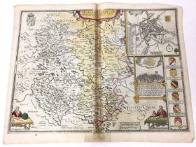
John Speed - 17th century Map of Herefordshire, with some hand colouring, sold by Roger Rea (1665), English text verso, plate 40 x 51cm
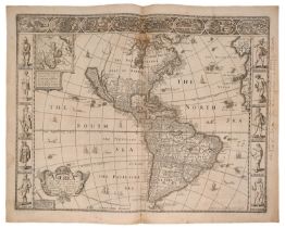
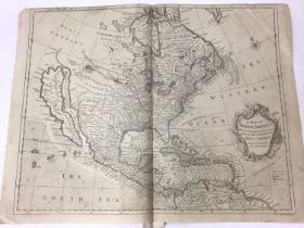
John Speed - 17th century engraved Map of America, dated 1626 (but 1676), sold by Baskett and Chiswell, pen inscriptions to margin, English text v...
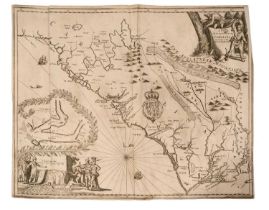
John Ogilby - rare engraved Map of Carolina, 1672 - "A New Discription of Carolina By Order of the Lords Proprietors" from Ogliby's, America; unco...
John Speed 17th century engraved map - Britain as it was Devided in the Tyme of the English Saxons
John Speed 17th century engraved map - Britain as it was Devided in the Tyme of the English Saxons especially during their Heptarchy, sold by Bass...
R W Seale, 18th century engraved map of North America and West Indies, Circa 1747, and Map of South America, both 38 x 48cm (plate)
Group of 17th century engraved maps by Speed, including Oxfordshire, Cumberland, Darbyshire, Wight Island, Somersetshire
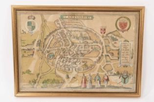
Georg Braun & Franz Hogenberg - Cantuarbury, 16th century engraved map with hand colouring, 30 x 44cm, glazed frame
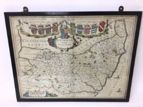
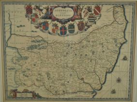
Johannes Blaeu: 17th century hand tinted engraved map of Suffolk, with German text verso, 38 x 49cm, glazed frame
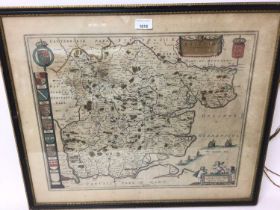
Johannes Blaeu: 17th century hand tinted engraved map of Essex, plate 43 x 52cm, glazed frame
![Thomas Bassett & Richard Chiswell [1676]](https://portal-images.azureedge.net/auctions-2024/srree10208/images/4815a316-73d7-4766-915c-b15800a9345b.jpg?h=210)
John Speede, 17th century map of Essex - devided into Hundreds, with the most ancient and fayre Towne Colchester Described and other Memorable Mon...
J Blaeu, hand coloured map of Norfolk, c1650. 38cm x 50cm, framed and glazed.
17th century hand coloured engraved map of Suffolk by Janssonius, 38cm x 49cm, in glazed frame
17th century hand coloured engraved map of Suffolk by Janssonius, 38cm x 49cm, in glazed frame
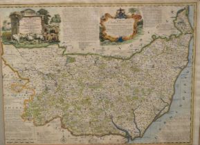
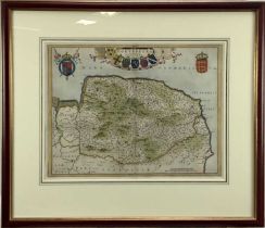
Mid 18th century hand coloured engraved map by Emanuel Bowen, 'Suffolk Divided into its Hundreds, 52
Mid 18th century hand coloured engraved map by Emanuel Bowen, 'Suffolk Divided into its Hundreds', 52cm x 70cm, in glazed frame