Filtered by:
- Sale Section
- List
- Grid
A subscription to the Price Guide is required to view results for auctions ten days or older. Click here for more information
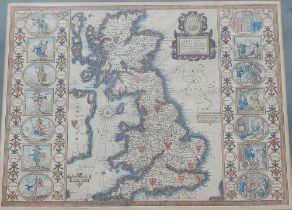

John Speed, 'Britain as it was divided in the tyme of the Englishe Saxons especially during their
John Speed, 'Britain as it was divided in the tyme of the Englishe Saxons especially during their Heptarchy', sold by Thomas Bassett and Richard C...
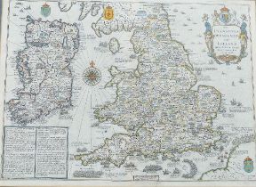
John Speed, 'The Invasions of England and Ireland with al their Civill Wars since the Conquest',
John Speed, 'The Invasions of England and Ireland with al their Civill Wars since the Conquest', sold by Thomas Bassett and Richard Chiswell, hand...
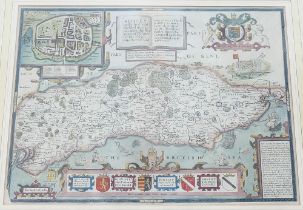
John Speed, 'Sussex Described and divided into Rapes, with the situation of Chichester the cheife
John Speed, 'Sussex Described and divided into Rapes, with the situation of Chichester the cheife citie thereof and the armes of such nobles as ha...
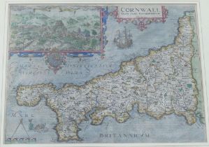
William Kip, 'Cornwall Olim pars Danmoniorum', after Christopher Saxton, published in 1607 (first
William Kip, 'Cornwall Olim pars Danmoniorum', after Christopher Saxton, published in 1607 (first edition) for Camden's Britannia, hand-coloured e...
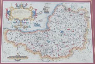
William Kip, 'Somersettensis Comitatus Vulgo Somersettshyre Qui olim pars suit. Bel Garum', after
William Kip, 'Somersettensis Comitatus Vulgo Somersettshyre Qui olim pars suit. Bel Garum', after Christopher Saxton, published for Camden's Brit...
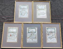
Emmanuel Bowen and John Owen, five 18th century hand coloured maps from 'Britannia Depicta or Ogilby
Emmanuel Bowen and John Owen, five 18th century hand coloured maps from 'Britannia Depicta or Ogilby Improved': 'The Road from London to Arudel in...
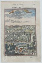
Allain Manesson Mallet, a hand coloured map (pg 161 figure LXX) and engraving (pg 127 Figure
Allain Manesson Mallet, a hand coloured map (pg 161 figure LXX) and engraving (pg 127 Figure XCVII) each entitled 'D L'Asie', circa 1683, from 'De...
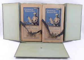
A collection of vintage Ordnance Survey folding maps comprised of a cased set of 10 maps of Scotland, scale 4 miles to 1 inch, another similar ca...
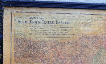
'Bacon's map of South East & Central England....Showing boroughs in separate colours, railways,
'Bacon's map of South East & Central England....Showing boroughs in separate colours, railways, roads and golf links', a wall chart with ebonised ...
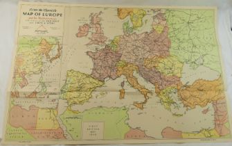
A WWII period 'Map of Europe and the Mediterranean.' printed by the News Chronicle, drawn by William
A WWII period 'Map of Europe and the Mediterranean.' printed by the News Chronicle, drawn by William Bromage, first edition May 1939, 27.5cm x 88...