Filtered by:
- Category
- List
- Grid
A subscription to the Price Guide is required to view results for auctions ten days or older. Click here for more information
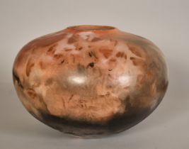

Attributed to Gabriele Koch, A large ovoid vessel with pink and black colouring, impressed 'K' mark,
Attributed to Gabriele Koch, A large ovoid vessel with pink and black colouring, impressed 'K' mark, 10" (25cm) high.
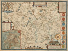
John Speed, a 17th Century map hand coloured map, 'Leicester both county and citie described, the
John Speed, a 17th Century map hand coloured map, 'Leicester both county and citie described, the honourable families that have the titles of Earl...
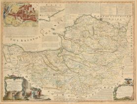
Emanuel Bowen, an 18th Century hand coloured map, 'An Improved Map of the County of Somerset', 21.5"
Emanuel Bowen, an 18th Century hand coloured map, 'An Improved Map of the County of Somerset', 21.5" x 28.25" (54.5 x 72cm).
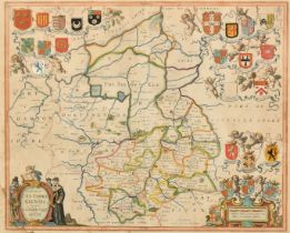
J. Janssonn, a hand-coloured engraved map of Cambridgeshire, label verso, 16.25" x 19.75" (41 x 50.
J. Janssonn, a hand-coloured engraved map of Cambridgeshire, label verso, 16.25" x 19.75" (41 x 50.5cm).
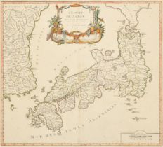
Gilles Robert de Vaugondy, an 18th Century map, 'L'Empire du Japon', outline coloured, visible
Gilles Robert de Vaugondy, an 18th Century map, 'L'Empire du Japon', outline coloured, visible size 19.5" x 21.75" (49.5 x 55cm).
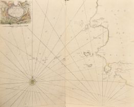
A collection of maps and plans mostly around the county of Hertford, also a map of Milford Haven and
A collection of maps and plans mostly around the county of Hertford, also a map of Milford Haven and the Islands Adjacent, all unframed (q).