Filtered by:
- Category
- List
- Grid
A subscription to the Price Guide is required to view results for auctions ten days or older. Click here for more information
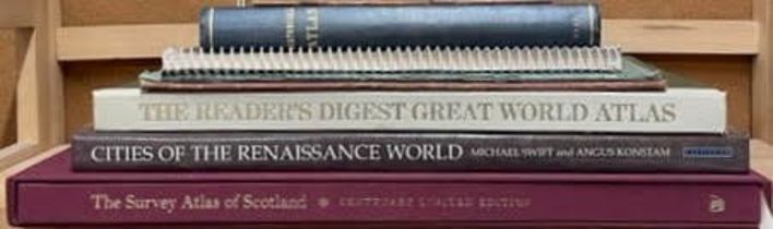

Maps and Atlases. Bartholomew, J.G. The Survey Atlas of Scotland. Edinburgh. Birlinn Ltd with The
Maps and Atlases. Bartholomew, J.G. The Survey Atlas of Scotland. Edinburgh. Birlinn Ltdwith The National Library of Scotland. 2012. Limited editi...
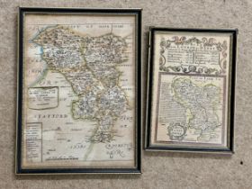
Two framed small antique hand coloured maps - "A Generall Mapp of the County of Darbie" image size
Two framed small antique hand coloured maps - "A Generall Mapp of the County of Darbie" image size approx. 26cm h x 19cm w, by Ric Blome c1670 tog...
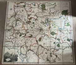
Large Martin (S.D) map folding into leather case ‘Country extending Ten Miles Round Leeds, including
Large Martin (S.D) map folding into leather case ‘Country extending Ten Miles Round Leeds, including Wakefield ,Bradford, Dewsbury, Otley, Harewoo...
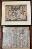
John Ogilby strip map of the road from York to Whitby & Scarborough circa 1700, 35cm x 47cm John
John Ogilby strip map of the road from York to Whitby & Scarborough circa 1700, 35cm x 47cm John Speede map of West Yorkshire 37cm x 51 cm, Robert...
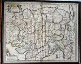
A hand coloured 18thC map of the Mogul Empire by Hendrik Hondius and Frederik de Wit circa 1730.
A hand coloured 18thC map of the Mogul Empire by Hendrik Hondius and Frederik de Wit circa 1730. 43cm x 53cm.
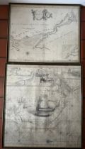
Two Captain Greenvile Collins maps, one of the Menai Straights and one the mid section of a map of
Two Captain Greenvile Collins maps, one of the Menai Straights and one the mid section of a map of the River Thames, 61cm x 58cm.