Filtered by:
- Category
- List
- Grid
A subscription to the Price Guide is required to view results for auctions ten days or older. Click here for more information
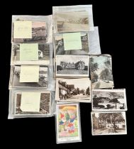

Postcard collection in a box with 500+ cards including many RP topographical cards from around the
Postcard collection in a box with 500+ cards including many RP topographical cards from around the UK including Sussex, Isle of Man, Devon, Cornwa...
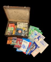
Ephemera, collection of Football Annuals to include; Sports Argus 1954-5 Football Annual, Sporting Record 1948-49, 1950-51, 1951-52, 1957-58, Foot...
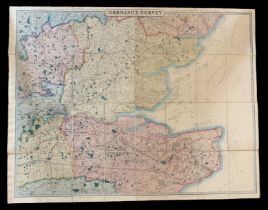
19th Century Ordnance Survey Map, London published by George Frederick Cruchley, Map Seller &
19th Century Ordnance Survey Map, London published by George Frederick Cruchley, Map Seller & Globe Maker, 81 Fleet Street. Large foldout Ordnance...
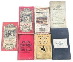
Small range of early 20th Century foldout Ordnance Survey / Road maps to include; Ordnance Survey
Small range of early 20th Century foldout Ordnance Survey / Road maps to include; Ordnance Survey Contoured Map of Bournemouth and Swanage, Ordnan...
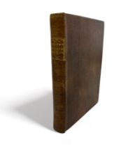
SPELMAN, HENRY. ‘ Villaire Anglicum: or A View of the Townes of England ‘ collected by the appointment of Sir Henry Spelman [1656]. Printed by R. ...
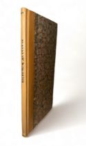
‘ A Survey of the County of Worcester ‘ including large foldout ‘ New Map of Worcestershire by
‘ A Survey of the County of Worcester ‘ including large foldout ‘ New Map of Worcestershire by William Tunnicliffe Land Surveyor 1788 ‘ (torn to ...