Filtered by:
- Category
4 items
- List
- Grid
A subscription to the Price Guide is required to view results for auctions ten days or older. Click here for more information
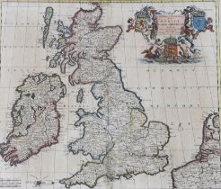

Lot 1713
Theodore Danckerts, antique hand coloured engraving, map of the British Isles, publ. Amsterdam, 61 x
Theodore Danckerts, antique hand coloured engraving, map of the British Isles, publ. Amsterdam, 61 x 50cm
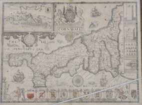
Lot 1714
After John Speed (1552-1629) Antique map of Cornwall, as described by the travills of John Norden,
After John Speed (1552-1629) Antique map of Cornwall, as described by the travills of John Norden, published by I Speed, 54 x 42cm

Lot 1750
A framed hand coloured engraving, Map of Brandenburg, by Mattheus Seutter, c.1730, 57 x 50cm
A framed hand coloured engraving, Map of Brandenburg, by Mattheus Seutter, c.1730, 57 x 50cm
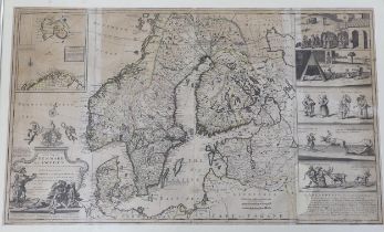
After Herman Moll, engraving, ‘New map of Denmark and Sweden’, circa 1715, 102 x 61cm