Filtered by:
- Category
- List
- Grid
A subscription to the Price Guide is required to view results for auctions ten days or older. Click here for more information
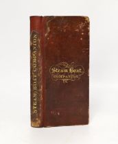

° ° The Steam-Boat Companion; and Stranger's Guide to the Western Islands and Highlands of Scotland....with voyages to Liverpool, and Belfast....a...
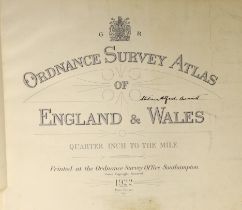
° ° Ordnance Survey Atlas of England and Wales: quarter inch to the mile. engraved title and 24 d-
° ° Ordnance Survey Atlas of England and Wales: quarter inch to the mile. engraved title and 24 d-page coloured maps (on linen), errata slip, (2)p...
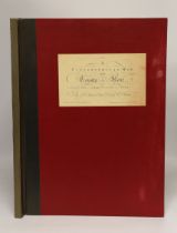
° ° Andrews, John and Others - A Topographical Map of the County of Kent, in twenty five sheets,
° ° Andrews, John and Others - A Topographical Map of the County of Kent, in twenty five sheets, on a scale of two inches to a mile, from an Actua...
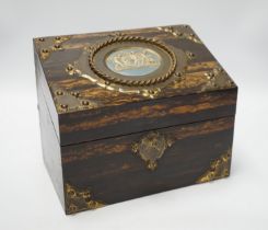
A Victorian coromandel stationery cabinet with inset blue and white plaque, 23.5cm x 14cm x 19cm
A Victorian coromandel stationery cabinet with inset blue and white plaque, 23.5cm x 14cm x 19cm
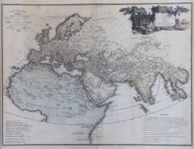
James Wyld Sr. (1790-1836) after Jean Baptiste Bourguignon d' Anville (1697-1782), Orbis Veteribus
James Wyld Sr. (1790-1836) after Jean Baptiste Bourguignon d' Anville (1697-1782), Orbis Veteribus Notus, 19th century hand coloured map, London 1...
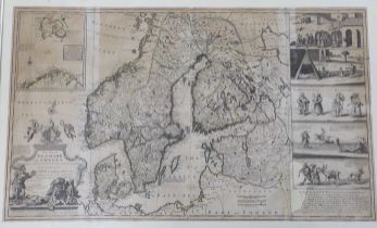
After Herman Moll, engraving, ‘New map of Denmark and Sweden’, circa 1715, 102 x 61cm
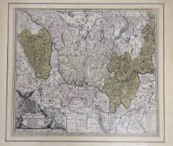
A framed map of Brandenburg, by Mattheus Seutter, c.1730, 57 x 50cm