Filtered by:
- Category
- List
- Grid
A subscription to the Price Guide is required to view results for auctions ten days or older. Click here for more information
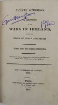

Stafford (Thos.) Pacata Hibernia; or, A History of the Wars in Ireland, during the Reign of Queen
Stafford (Thos.) Pacata Hibernia; or, A History of the Wars in Ireland, during the Reign of Queen Elizabeth. 2 vols. in one, roy 8vo Dublin (Hiber...
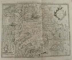
Maps: Stafford (Thos.) Pacata Hibernia, bound volume of maps, from 1810 Edition, lg. fold. Map of
Maps: Stafford (Thos.) Pacata Hibernia, bound volume of maps, from 1810 Edition, lg. fold. Map of Mounster, lg. Map of Battle of Kinsale, & 17 ot...
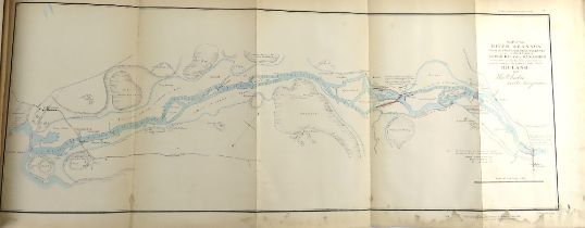
The River Shannon Maps & Plans: River Shannon Navigation. Letter from Colonel John F. Burgoyne to
The River Shannon Maps & Plans: River Shannon Navigation. Letter from Colonel John F. Burgoyne to the Rt. Hon. Sir John Cam. Hobhouse, Bart.; an...
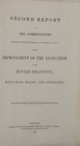
The River Shannon Maps & Plans: J.F. Burgoyne, Richard Griffith, & Harry D. Jones: The Commissioners
The River Shannon Maps & Plans: J.F. Burgoyne, Richard Griffith, & Harry D. Jones: The Commissioners Appointed .. for the Improvement of the Navi...
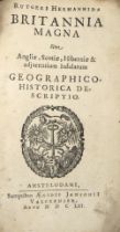
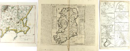
With Folding Engraved Maps Hermannidae (Rutgeri) Britannia Magna, sive Angliae, Scotiae, Hiberniae &
With Folding Engraved Maps Hermannidae (Rutgeri) Britannia Magna, sive Angliae, Scotiae, Hiberniae & adjacentium Insularum Geographico - Historic...
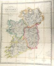
Irish Map: Collins (H.G.) Collins Railway Map of Ireland, exhibiting the Mail, Coach and Turnpike
Irish Map: Collins (H.G.) Collins Railway Map of Ireland, exhibiting the Mail, Coach and Turnpike Roads, Lake Rivers, Canals etc., coloured, linen...
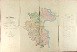
Irish Map: Index to the Townland Survey of the County of Louth and the County of the Town of
Irish Map: Index to the Townland Survey of the County of Louth and the County of the Town of Drogheda, fold. map, cold. in outline, D. Co.'s Phoen...
Co. Clare Interest: Rental and Particulars of the First Division of the Valuable Fee-Simple Lands
Co. Clare Interest: Rental and Particulars of the First Division of the Valuable Fee-Simple Lands and Hereditaments - The Estate of the Most Honor...
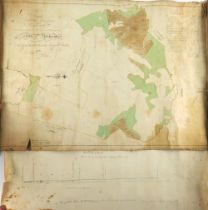
Co. Westmeath: Manuscript Map - Byron (Sam.) cartographer, A Survey of Ballrowan, Kerynstown, &
Co. Westmeath: Manuscript Map - Byron (Sam.) cartographer, A Survey of Ballrowan, Kerynstown, & Clonecully in the Barony of Farbill, Parish of Kil...
Irish Map: Neville (A.R.)cart. A Map of Part of the Estate of the Hon. City of Dublin, extending
Irish Map: Neville (A.R.)cart. A Map of Part of the Estate of the Hon. City of Dublin, extending from Church Street on the East to Lincoln Lane o...
![Irish Maps: [Speed (J.), Janson(J.), Hondius (J.)] A set of four hand coloured Maps, to include: *](https://portal-images.azureedge.net/auctions-2023/srfons10064/images/6d60f41f-35dc-466d-a1aa-b0c100f65094.jpg?h=210)
Irish Maps: [Speed (J.), Janson(J.), Hondius (J.)] A set of four hand coloured Maps, to include: *
Irish Maps: [Speed (J.), Janson(J.), Hondius (J.)] A set of four hand coloured Maps, to include: * Provincia Connachtiae - Province of Connaguht -...
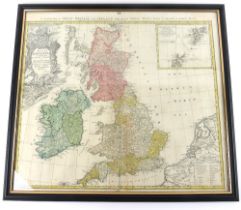
Map: H. Homann, Magna Britannia complectens Angliae, Scotiae et Hyberniae Regn., A General Map of
Map: H. Homann, Magna Britannia complectens Angliae, Scotiae et Hyberniae Regn., A General Map of Great Britain and Ireland, with part of Holland,...
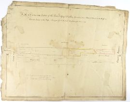
![Rare County Galway Manuscript Map Map: Co. Galway - [Logan (Michael) cartographer] A Survey of the](https://portal-images.azureedge.net/auctions-2023/srfons10064/images/9236a9f3-a6e1-4c1e-a677-b0c100f652e4.jpg?h=210)
Rare County Galway Manuscript Map Map: Co. Galway - [Logan (Michael) cartographer] A Survey of the
Rare County Galway Manuscript Map Map: Co. Galway - [Logan (Michael) cartographer] A Survey of the Lands of Pallase and Ballydoogan situate in th...
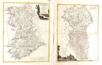
Irish Map: Zatta (Antonio) Parte del Regno d'Irlandia - Le Provincie di Connaught e Munster, et Le
Irish Map: Zatta (Antonio) Parte del Regno d'Irlandia - Le Provincie di Connaught e Munster, et Le Province D'Ulster e Leinster, 2 parts, Venice 1...
Irish Maps: Chatelain (Henri Abraham) Carte Ancienne et Moderne de L'Irlande, avec quelque Remarques
Irish Maps: Chatelain (Henri Abraham) Carte Ancienne et Moderne de L'Irlande, avec quelque Remarques sur son Gouvernement et sur l'Etat present de...
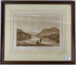
After Jonathan Fisher (1740-1809) "A Picturesque Tour of Killarney, describing in Twenty Years,"
After Jonathan Fisher (1740-1809) "A Picturesque Tour of Killarney, describing in Twenty Years," 17 (ex. 20) acquatint Views engraved by Jonathan...
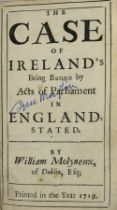
Molyneux (William) The Case of Ireland's Being Bound by Acts of Parliament in England, Stated,
Molyneux (William) The Case of Ireland's Being Bound by Acts of Parliament in England, Stated, 12mo [Dublin] 1719. Title within ruled borders, (IX...
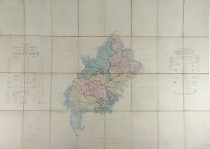
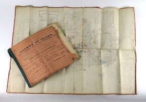
Irish Map: Index to the Townland Survey of the County of Longford, fold., linen backed, hand
Irish Map: Index to the Townland Survey of the County of Longford, fold., linen backed, hand coloured, D. (O.S. Phoenix Park) 1838, green cloth. A...
![Map: [Austria] (Mansfeld, Kupferstich et al) Grundriss der Stadt Wien 1818 - Zu haben bey Artaria](https://portal-images.azureedge.net/auctions-2023/srfons10064/images/5a2bc07e-9a72-45aa-ae14-b0c100f71db3.jpg?h=210)
Map: [Austria] (Mansfeld, Kupferstich et al) Grundriss der Stadt Wien 1818 - Zu haben bey Artaria
Map: [Austria] (Mansfeld, Kupferstich et al) Grundriss der Stadt Wien 1818 - Zu haben bey Artaria und Comp. am Kohlmarkt, fold. hand coloured, lin...
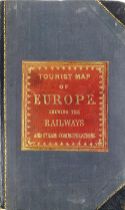
Map: Cruchley (G.F.) Cartrographer A New Map of Europe, Exhibiting its Natural and Political
Map: Cruchley (G.F.) Cartrographer A New Map of Europe, Exhibiting its Natural and Political Divisions..., folding, linen backed, coloured, publis...
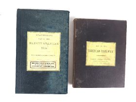
Maps: Stanford (Ed.)cart. Map of the Siberian Railway, the Great Land Route to China and Korea,
Maps: Stanford (Ed.)cart. Map of the Siberian Railway, the Great Land Route to China and Korea, folding, linen backed, coloured map, London (Stanf...
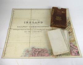
Railway Map: A General Map of Ireland to Accompany the Report of the Railway Commissioners, Showing the Principal Physical Features and Geological...
![Roscommon & Kings County: [O'Donovan (John)] Letters ... Relating to the Antiquities of the Kings](https://portal-images.azureedge.net/auctions-2023/srfons10064/images/b4e46ec2-da13-49e2-850d-b0c100f74f71.jpg?h=210)
Roscommon & Kings County: [O'Donovan (John)] Letters ... Relating to the Antiquities of the Kings
Roscommon & Kings County: [O'Donovan (John)] Letters ... Relating to the Antiquities of the Kings County. Collected during the.. Ordnance Survey i...
![Co. Galway: [O'Donovan (John)] Letters ... relating to the Antiquities of the County of Galway,](https://portal-images.azureedge.net/auctions-2023/srfons10064/images/f84bec2b-be7f-4fb9-bd57-b0c100f7501f.jpg?h=210)
Co. Galway: [O'Donovan (John)] Letters ... relating to the Antiquities of the County of Galway,
Co. Galway: [O'Donovan (John)] Letters ... relating to the Antiquities of the County of Galway, Collected during the .. Ordnance Survey in 1839, 3...