Filtered by:
- Sale Section
- List
- Grid
A subscription to the Price Guide is required to view results for auctions ten days or older. Click here for more information
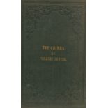

The Krima or Crimea Peninsula, the Tauris of Ancient Geographers, reduced from the Original Russian military map, constructed under the direction ...
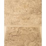
Baker (B) Ordnance Map of Hampshire, published by Col. Mudge Tower, 14th Aug 1817, folding map of 52 linen backed panels, 465cm x 91cm and the gre...
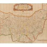
Robert Morden/Map of Suffolk/hand coloured engraving, 37cm x 44cm CONDITION REPORT: Condition information is not usually provided in the descripti...
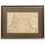
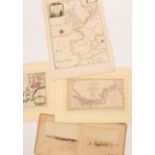
William Henry Toms (c. 1700-c. 1755)/Arabia, Petraea et Deferta/engraving, 20cm x 30.5cm and four other maps CONDITION REPORT: Condition informati...
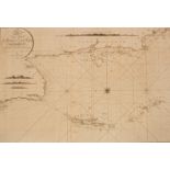
William Heather (fl.
William Heather (fl. 1765-1812)/A new Chart of the Andaman and Nicobar Islands with the Adjacent Continent, Corrected & Improved by W Heather 1803...
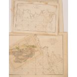
Harrison & Co after James Cook (1728-1779)/Chart of the N W Coast of America and N E Coast of Asia,
Harrison & Co after James Cook (1728-1779)/Chart of the N W Coast of America and N E Coast of Asia, Explored by Capt Cook in the Years 1778 and 17...
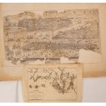
After Captain Hayter/A Chart of the Coast of Pegu with the Adjacent Coast of Arakan and Tanasserim
After Captain Hayter/A Chart of the Coast of Pegu with the Adjacent Coast of Arakan and Tanasserim from A Drawing Communicated by Captain Hayter, ...
Jacques-Nicolas Bellin (1703-1772)/Carte De l'Isle de Cheu-Chan ou Isle de Chusan de la Province de
Jacques-Nicolas Bellin (1703-1772)/Carte De l'Isle de Cheu-Chan ou Isle de Chusan de la Province de Che-kiang Avec les Cotes et Isles Voisines, 17...