
Filtered by:
- Category
- List
- Grid
A subscription to the Price Guide is required to view results for auctions ten days or older. Click here for more information

An Account of the Operations carried on for accomplishing A Trigonometrical Survey of England and
An Account of the Operations carried on for accomplishing A Trigonometrical Survey of England and Wales, first published in, and now revised from,...
Proceedings of the DNHAS Vol. 68. Contains ‘The Plates in Hutchins’ History of Dorset’ by G. D.
Proceedings of the DNHAS Vol. 68. Contains ‘The Plates in Hutchins’ History of Dorset’ by G. D. Squibb – the only reliable way of checking presenc...
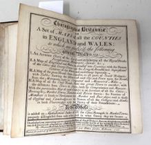
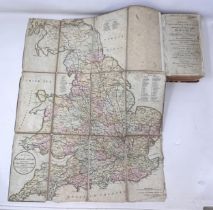
Thomas Badeslade & William Toms, Chorographia Britanniae or A Set of Maps of all the Counties of
Thomas Badeslade & William Toms, Chorographia Britanniae or A Set of Maps of all the Counties of England and Wales, 1742, a pocket atlasProvenance...
Cary’s Itinerary, 1817, by John Cary, half-bound in leather with marbled paper covers Provenance:
Cary’s Itinerary, 1817, by John Cary, half-bound in leather with marbled paper coversProvenance: From the collection of David Beaton, local histor...
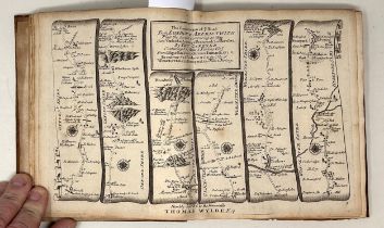
John Owen & Emanuel Bowen, Britannia Depicta, 1720, first edition of a pocket road atlas that went
John Owen & Emanuel Bowen, Britannia Depicta, 1720, first edition of a pocket road atlas that went through many subsequent editionsProvenance: Fro...
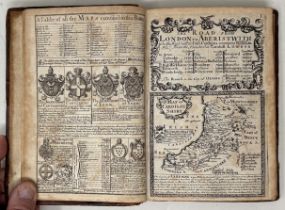
Thomas Gardner, A Pocket Guide to the English Traveller, 1719, the first pocket road atlas ever
Thomas Gardner, A Pocket Guide to the English Traveller, 1719, the first pocket road atlas ever published, 2 vols.Provenance: From the collection ...
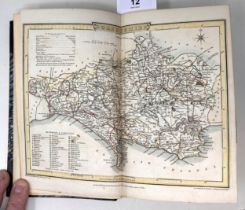
The Beauties of England and Wales – Dorsetshire, published James Cawthorn, London, 1803, quarter
The Beauties of England and Wales – Dorsetshire, published James Cawthorn, London, 1803, quarter bound leather and marbled paper on board, frontis...
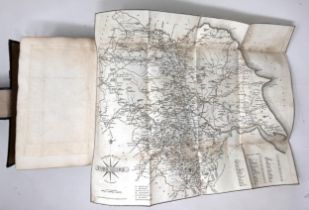
Paterson’s Roads, 1822, bound in black linen on board, with marbled endpapers and marbled page
Paterson’s Roads, 1822, bound in black linen on board, with marbled endpapers and marbled page edges, including county maps from Cary’s Travellers...
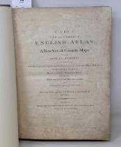
John Cary’s New & Correct English Atlas, 1787, an early example of accurate mapping, and a subscribers’ edition. Rebound in light brown leather wi...
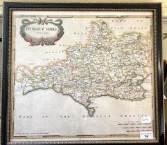
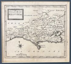
Robert Morden, 1695, Map of Dorset, first edition, from Camden’s Britannia (Stoke Wake printed
Robert Morden, 1695, Map of Dorset, first edition, from Camden’s Britannia (Stoke Wake printed twice, unique to first edition), 38 x 42 cmProvenan...
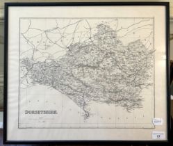
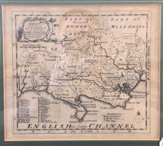
Frontispiece map from The Old Stone Crosses of Dorset, by Alfred Pope, 1906, 41 x 48 cmProvenance: From the collection of David Beaton, local hist...

Badeslade & Toms, map of Dorset 1742, 15.5 x 15.5 cm Provenance: From the collection of David
Badeslade & Toms, map of Dorset 1742, 15.5 x 15.5 cmProvenance: From the collection of David Beaton, local historian, retired academic and author ...
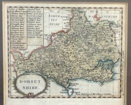
Francis Grose’s map, Dorset, printed from John Seller’s plate of 1695, 21.5 x 16 cm Provenance: From
Francis Grose’s map, Dorset, printed from John Seller’s plate of 1695, 21.5 x 16 cmProvenance: From the collection of David Beaton, local historia...
Emmanuel Bowen, map of Dorset, from Arts & Sciences, issued from 1759 – 1763, 19 x 22 cm Provenance:
Emmanuel Bowen, map of Dorset, from Arts & Sciences, issued from 1759 – 1763, 19 x 22 cmProvenance: From the collection of David Beaton, local his...
John Rocque, map of Dorset, from Small British Atlas, probably 1753, but maybe from a later edition 1762, 1764 or 1769, 17 x 20 cmProvenance: From...
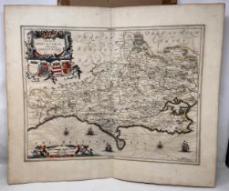
Jan Jansson, map of Dorset, 1650, 49.5 x 58 cm Provenance: From the collection of David Beaton,
Jan Jansson, map of Dorset, 1650, 49.5 x 58 cmProvenance: From the collection of David Beaton, local historian, retired academic and author of Dor...
Richard Blome, map of Dorset, 1671, 26 x 33 cm Provenance: From the collection of David Beaton,
Richard Blome, map of Dorset, 1671, 26 x 33 cmProvenance: From the collection of David Beaton, local historian, retired academic and author of Dor...
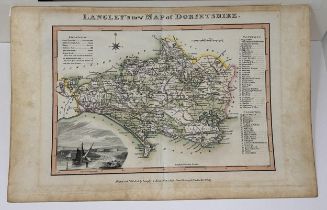
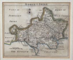
Langley & Belch, map of Dorset, 1817, 20 x 28 cm Provenance: From the collection of David Beaton,
Langley & Belch, map of Dorset, 1817, 20 x 28 cmProvenance: From the collection of David Beaton, local historian, retired academic and author of D...
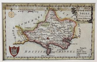
Map of Dorset, J Roper engraver, pub. Vernor & Hood 1805, frontispiece map in Beauties of England & Wales, 20 x 25 cmProvenance: From the collecti...
John Aiken, map of Dorset, 1800, 10 x 6 cm Provenance: From the collection of David Beaton, local
John Aiken, map of Dorset, 1800, 10 x 6 cmProvenance: From the collection of David Beaton, local historian, retired academic and author of Dorset ...
Kitchin & Jeffreys, map of Dorset, 1780, 20 x 15 cm Provenance: From the collection of David Beaton,
Kitchin & Jeffreys, map of Dorset, 1780, 20 x 15 cmProvenance: From the collection of David Beaton, local historian, retired academic and author o...
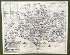
Thomas & John Osborne, map of Dorset, 1748, 16.5 x 18.5 cm Provenance: From the collection of
Thomas & John Osborne, map of Dorset, 1748, 16.5 x 18.5 cmProvenance: From the collection of David Beaton, local historian, retired academic and a...
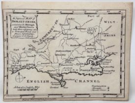
Thomas Conder, map of Dorset, 1784, 11 x 17.5 cm Provenance: From the collection of David Beaton,
Thomas Conder, map of Dorset, 1784, 11 x 17.5 cmProvenance: From the collection of David Beaton, local historian, retired academic and author of D...
John Cowley, map of Dorset, 1744, 15 x 19 cm Provenance: From the collection of David Beaton,
John Cowley, map of Dorset, 1744, 15 x 19 cmProvenance: From the collection of David Beaton, local historian, retired academic and author of Dorse...

Treves (Sir Frederick), Highways and Byways in Dorset, Macmillan, 1906, 1st ed. bound green linen on
Treves (Sir Frederick), Highways and Byways in Dorset, Macmillan, 1906, 1st ed. bound green linen on board, and assorted books on DorsetProvenance...
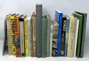
Good (Ronald), The Old Roads of Dorset, Horace G. Commin Ltd., 1966, and assorted books on Dorset
Good (Ronald), The Old Roads of Dorset, Horace G. Commin Ltd., 1966, and assorted books on DorsetProvenance: From the collection of David Beaton, ...
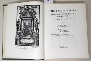
Chubb (Thomas), The Printed Maps in the Atlases of Great Britain and Ireland 1579 – 1870, Dawsons of
Chubb (Thomas), The Printed Maps in the Atlases of Great Britain and Ireland 1579 – 1870, Dawsons of Pall Mall 1974, 1st edition, bound in green l...

Catalogue of Maps in the Essex Record Office 1566 – 1837 Essex County Council 1947, 1st edition,
Catalogue of Maps in the Essex Record Office 1566 – 1837 Essex County Council 1947, 1st edition, bound in green linen on board and assorted books ...
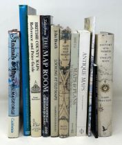
Tooley (R.V), Maps and Map-Makers, Batsford, fourth impression, 1962, bound in orange linen on
Tooley (R.V), Maps and Map-Makers, Batsford, fourth impression, 1962, bound in orange linen on board, and assorted books on cartographyProvenance:...
Smart (L), Maps That Made History, National Archives Kew 2004, 1st edition, bound in blue linen on
Smart (L), Maps That Made History, National Archives Kew 2004, 1st edition, bound in blue linen on board, and assorted books on cartographyProvena...
Skelton (R A), Decorative Printed Maps of the 15th to 18th Centuries, Spring Books 1967, 3rd impression, bound in blue linen on board, and assorte...
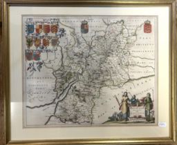
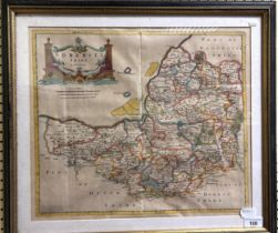
A map of Gloucestershire, by Caricta Borealis Vulgo, 42 x 50 cm, and a map of Somersetshire, 31 x 47
A map of Gloucestershire, by Caricta Borealis Vulgo, 42 x 50 cm, and a map of Somersetshire, 31 x 47 cm (2)
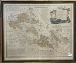
A map of Berkshire, 45 x 54 cm, a map of Zanzibar, 20 x 23 cm, and four other maps (6) Zanzibar Map:
A map of Berkshire, 45 x 54 cm, a map of Zanzibar, 20 x 23 cm, and four other maps (6)Zanzibar Map: Part printed and hand painted
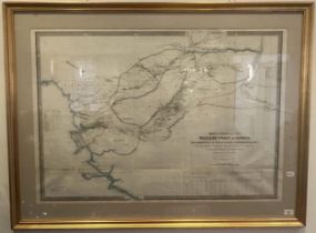
A Map of Part Of The Western Coast Of Africa Extending From The Isles De Los Do Sherburo Island
A Map of Part Of The Western Coast Of Africa Extending From The Isles De Los Do Sherburo Island Particularly Exhibiting The Discoveries Lately Mad...
M Phillips, The Grand Southern Tour Of England map, dated 1818Condition poor, folded and unframed, sold with all faults not subject to return
Robert Morden, map of Somerset, 35 x 43 cm