Filtered by:
- Category
- List
- Grid
A subscription to the Price Guide is required to view results for auctions ten days or older. Click here for more information

North Sea. Moll (Herman) A Chart of Part of Sea Coast of England, Holland & Flanders &c.an engraved sea chart with hand colouring, c.1740, from th...
Essex. Collins (Greenville) Harwich Woodbridg and Handfordwater with the Sands from the Nazeland to Hosely Bay an 18th century engraved sea chart ...
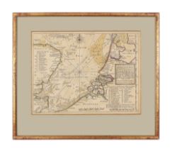
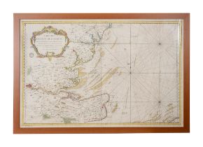
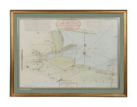
Thames Estuary. Price (Charles) The River of Thames from London To The Buoy of ye NoureWilliam Mount and Thomas Page, 9c.1695), an engraved chart ...
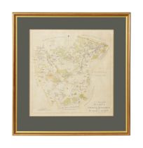
Hasted, (Edward) A Map of the Hundreds of Middleton alias Milton and of Tenham late 18th century, a folding engraved map with wash handcolouring f...
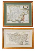
Morden (Robert) Maps Essex and Kentfirst engraved by Nicholls (S), sold by A Swall, A Churchill and Partner, second, early 18th century, engraved ...
Thames Estuary. Bellin (Jacques Nicholas) Cartes Des Entrees De La Tamise Paris 1759, an engraved folding chart with hand colouring, large strapwo...
North Sea. Collins (Greenville) North Sea Coast Chart an 18th century double page folding engraving with handcolouring and dedication to Admiral B...
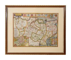
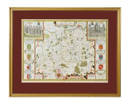
Kent. Speed (John). Kent with her Cities and Earles Described and ObservedBassett & Chiswell, 1676, an engraved folding map with hand colouring, i...
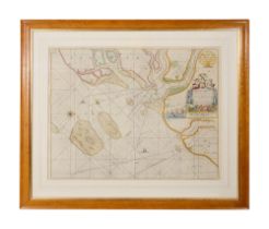
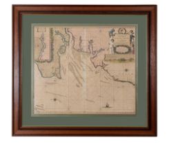
Kent. Stephensen (John) A survey of the East Swale from the Buoys of the Narrows and Spaniard Robert Sayer, 1786, an engraved double page folding ...
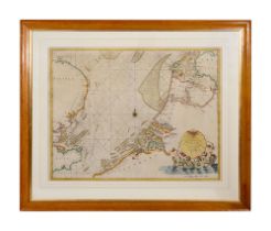
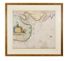
Thames estuary. Van Keulen (Johannes) Nieuwe Paskaert van d'Oost Kust van Engelandt van Dover tot Dunwich als mede de teems off de Rivier Thamesa...
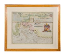
Suffolk/Norfolk. Van Keulen (Joannes) Pas-Caert Vande Zee-cussen van Engeland Van Orfordnes tot den Flamborger Hooft a double page folding engrave...
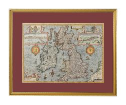
British Isles. Speed (John). The Kingdome of Great Britaine and Ireland J Sudbury and George Humble, 1610, folding engraved map by Hondius with ha...
Surrey. Speed (John). Surrey Described and Divided into Hundreds Thomas Bassett and Richard Chiswell, (1676), an engraved folding map with hand co...
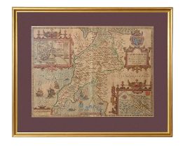
Wales - Caernarvonshire. Speed (John). Caernarvon Both Shyre and shire-towne with ancient Citie Bangor described Henry Overton, (1743), an engrav...
Sussex. Norden (John) & Speed (John). Sussex Described and divided into Rapes with the situation of Chichester the citie and the armes of such Nob...

Middlesex. Norden (John) & Speed (John). Middle-sex described with the most famous Cities of London and Westminster Henry Overton, c.1720, an engr...
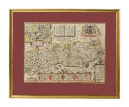
Kent. Morden (Robert) Map of Kent c.1700 an engraved folding map with hand colouring, large strapwork cartouche, old foldswithin mount 36 x 64 cm...
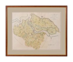
Hasted (Edward) A map of the 'The Hundred of Bromley & Beckenham and the Hundred of Ruxley an engraved folding map with hand colouring, from Edwar...
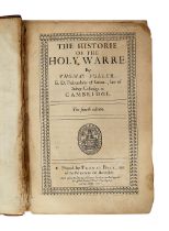
Crusades - Fuller (Thomas) The Historie of the Holy Warre fourth edition, by Buck London, 1651, A declaration of the frontis, b&w engraved fronti...
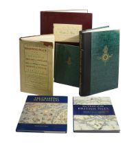
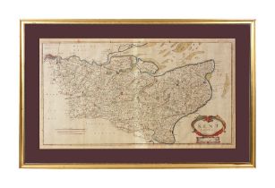
Antiquarian Maps. Facsimiles and other titlesA topographical Map of the County of Kent, by Andrews, Dury and Herbert originally published 1769, re...