Refine your search
Filtered by:
- Sale Section
- List
- Grid
A subscription to the Price Guide is required to view results for auctions ten days or older. Click here for more information

ATLAS, du Voyage de Decouvertes, A L'ocean Pacifique du nord, et Autour du Monde, Par George Vancouver; Traduit de l'anglais par P.F. Henry; compo...
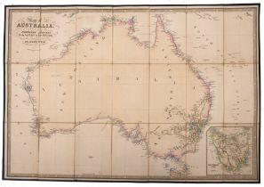
AUSTRALIA, Map of Australia, Compiled from the Nautical Surveys, made by the order of the Abumthy and other, Authentic Documents by James Wilde, i...
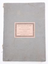
( BOWYER, R) An Illustrated Record of Important Events in the Annals of Europe, during the last four years, comprising a series of views of the pr...
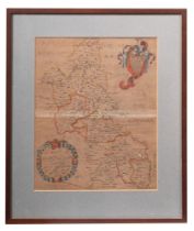
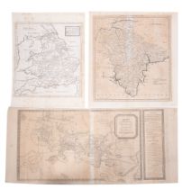
BUCKINGHAMSHIRE, with its hundreds: hand coloured map by Richard Blome, 320 x 265 mm, paper age discoloured, circa 1681, with two other hand colou...
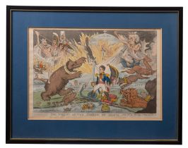
CARTOON/ CARICATURE, 'A Table for Ministers', hand coloured plate, published by Thomas McKlean,
CARTOON/ CARICATURE, 'A Table for Ministers', hand coloured plate, published by Thomas McKlean, 1832, f & g, with 'The Valley of the Shadow of Dea...
COLLINS, Capt.
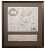
COLLINS, Capt. Greenville - The Islands of Scilly - hand coloured sea chart, size of the actual map 560 x 440 mm, with - Toovey's " A True Descri...
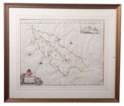
COLLINS, Capt. Greenville - The Isle of Man, hand coloured sea chart. 570 x 450 mm., attractively coloured, framed and glazed, 1693 (or later)
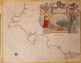
COLLINS, Captain Greenville - hand coloured sea chart : TORBAY//SOUTH DEVON . size : 565 x 445 mm, highly decorative chart depicting in one quarte...
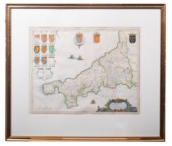
CORNWALL- Curnbura Cive Cornwallie: hand coloured map by Jan Blaeu, 485 x 360 mm, f & g.
CORNWALL... (Cornubia Cive Cornwallia), Jan Blaeu, hand coloured map, 51 x 40.5 cm, in an 'old' Hogarth frame, Latin text on verso, circa 1645, wi...
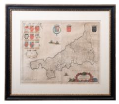
CORNWALL: hand coloured map by John Speed, size 490 x 360 mm, published by John Sudbury and G Humble, circa 1610, attractive f & g.
DAVIES, B.
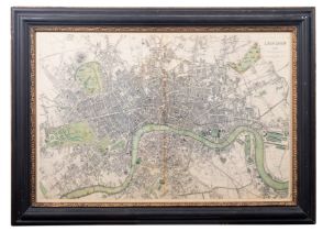
DAVIES, B. R - A Map of London,1843 : Coloured map in ebony and gilt bevelled frame, size 880 x 580 mm, published Nov. 1st 1843. Extends from Kens...
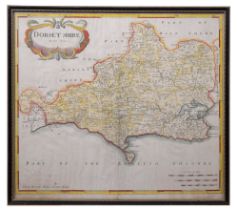
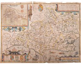
DORSETSHIRE: hand coloured map by Robert Morden, 420 x 360 mm, attractively hand coloured in Hogarth frame, circa 1695.
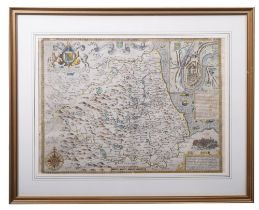
DURHAM, Episcopatus Dunblmensis Vulgo Bishoprioke of Durham- hand coloured map by Jan Blaeu,
DURHAM, Episcopatus Dunblmensis Vulgo Bishoprioke of Durham- hand coloured map by Jan Blaeu, attractively f&g, size 465 x 360 mm, circa 1645.
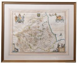
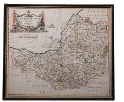
DURHAM, The Bishoprieke and Citie of Durham: hand coloured map, by John Speed, 495 x 375 mm,
DURHAM, The Bishoprieke and Citie of Durham: hand coloured map, by John Speed, 495 x 375 mm, attractively f&g, circa 1610, with English text in th...
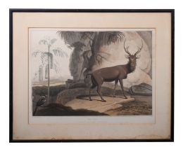
ELK, drawn and published by Samuel Daniel, hand coloured aquatint, 46 x 33cm, 1807.
GREENWOOD, C.J.
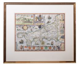
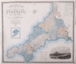
GREENWOOD, C.J. Map of the County of Cornwall from an actual survey, made in the years 1826 and 1827, map with full wash colouring with inset of t...
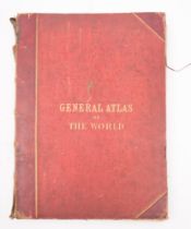
HALL, Sidney, and William Hughes, General Atlas of the World: Containing upward of 70 Maps,
HALL, Sidney, and William Hughes, General Atlas of the World: Containing upward of 70 Maps, coloured maps, engraved on Steel, original half morocc...
HAYTOR GRANITE QUARRIES: a pair of hand coloured aquatints, "An Exterior View of the Haytor Granite Quarries". With "An Interior View of the Devon...
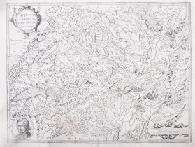
HELVETIA (Switzerland): uncoloured map after Mercator, 445 x 335 mm, Circa 17th Century.
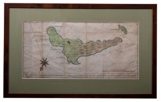
JUAN FERNANDES ISLAND: hand coloured map, showing crease marks, 490 x 240 mm, f & g, Circa 18th Century.
KITCHEN, Thomas - Bowles's Reduced Map of Devonshire, uncoloured map, size 280 x 310mm, age discoloured, 2 short tears without loss, 1782, With - ...
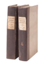
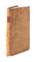
MGREGOR, John, British America, 2 vols, sixteen folded maps, linen-backed paper covered boards with printed paper spine labels, 8vo, William Bla...
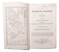
MISSIONARY REGISTER paper covers, 8 engravings of maps etc, maps and plates complete, paper covered boards, 1819.
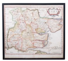
MORDEN, Robert, hand-coloured copper engraved map of Essex, 415 x 350 mm, framed and glazed,
MORDEN, Robert, hand-coloured copper engraved map of Essex, 415 x 350 mm, framed and glazed, circa 1695.
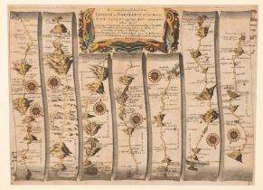
OGILBY, JOHN - The Continuation of the road from London to Barnstaple, hand coloured strip road map,
OGILBY, JOHN - The Continuation of the road from London to Barnstaple, hand coloured strip road map, 440 x 320 mm, c1675.
OVERTON, Henry, Dorsetshyre hand-coloured map, size 500 x 375 mm, 1662, short tears at edges,
OVERTON, Henry, Dorsetshyre hand-coloured map, size 500 x 375 mm, 1662, short tears at edges, without loss.
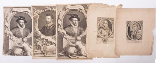
PRINTS- Two Large Highly Decorative Copper Engravings of Sir Walter Raleigh and Sir Francis Drake,
PRINTS- Two Large Highly Decorative Copper Engravings of Sir Walter Raleigh and Sir Francis Drake, 37 x 21 cm; together with a few others relating...
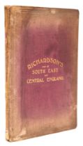
RICHARDSON'S Map of South East and Central England, large folding coloured map, opening to 93 x 120 cm, n.d; together with BUTLER, Samuel, An Atla...
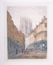
ROWBOTHAM, Claude, 1864-1946, Low Petergate, signed coloured etching, 19.5 x 14.5 cm.
SOMERSETSHIRE: hand coloured map by Robert Morden, 420 x 360, in Hogarth frame.
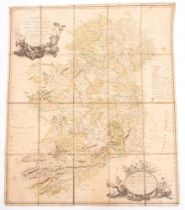
TAYLOR, Alexander, New Map of Ireland, Showing the Great Features of the Country, described in a Manner highly expressive, and the Distances Betwe...
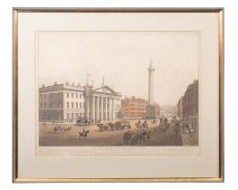
The New Post Office, Sackville Street, Dublin: engraved by R Havell & Son and published by Del Vecchio, hand coloured aquatint, 595 x 440 mm, f & ...