Filtered by:
- Category
- List
- Grid
A subscription to the Price Guide is required to view results for auctions ten days or older. Click here for more information
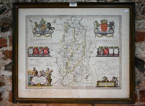

A 17th century county map engraving by Johannes Blaeu, Nottinghamshire, 39 x 50.5 cm, framed with
A 17th century county map engraving by Johannes Blaeu, Nottinghamshire, 39 x 50.5 cm, framed with text to reverse (stain and mould)

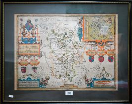
A 17th century County map engraving of Lincolnshire, Jacob Hondius 1610, mounted framed and
A 17th century County map engraving of Lincolnshire, Jacob Hondius 1610, mounted framed and glazed (trimmed)
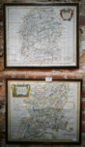
A 17th century county map engraving by John Speed after Jacob Hondius, Bedford Shire, 39 x 51.5
A 17th century county map engraving by John Speed after Jacob Hondius, Bedford Shire, 39 x 51.5 cm, mounted framed and glazed
Two 17th century county map engravings by Robert Morden, Hampshire and Wiltshire, 35 x 41 cm, framed
Two 17th century county map engravings by Robert Morden, Hampshire and Wiltshire, 35 x 41 cm, framed and glazed (2)
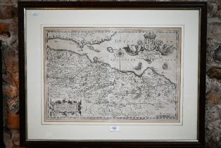
A 17th century county map engraving of the shires of Lothian and Linlitquo (sic), by Timothy Pont
A 17th century county map engraving of the shires of Lothian and Linlitquo (sic), by Timothy Pont after Jacob Hondius (uncoloured), 37.5 x 54.5 cm...
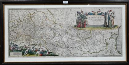
An 18th century map engraving by William Blaeu, 'Danubius Fluvius Europae Maximus', 41.5 x 96.5
An 18th century map engraving by William Blaeu, 'Danubius Fluvius Europae Maximus', 41.5 x 96.5 cm, mounted framed and glazed